01
Hesten and Stavelitippen
- Distance
- About 4.5 km loop
- Time
- About 3 hr
- Ascent
- About 489 m
- Level
- Demanding
- Start area
- Fjordgård / Seglavegen
- Best for
- The classic view towards Segla
Senja field guide · 10 routes compared
Senja combines sharp coastal peaks, deep fjords and short approaches with terrain that can become demanding very quickly. Compare the island's best-known hikes, understand Hesten versus Segla, and choose a route that fits your time and experience.
The short answer
The famous mountain and the famous photograph are not the same outing. Start with the experience, then let conditions decide whether the mountain is sensible that day.
Distances, ascent and times are approximate. Different starts, return choices and tracking methods produce different totals; always open the current route description before departure.
Planning a wider trip? Read the complete Senja travel guide.Route comparison
Use this as a first filter, not a promise of conditions. The classification shown follows the cited route where possible, while weather can move every hike into a harder category.
01
02
03
04
05
06
07
08
09
10
The local source calls the South Senja coastal route Dronningruta; it is also referred to as Dronningstien. Its current description is about 8 km one way, not a fixed 8.6 km loop. For Grytetippen and Keipen, totals change significantly with the start and whether one or both summits are included.
The essential choice
Choose the mountain that matches your purpose. The viewpoint and the summit create two very different days, even though both are reached from Fjordgård.
Choose Hesten when
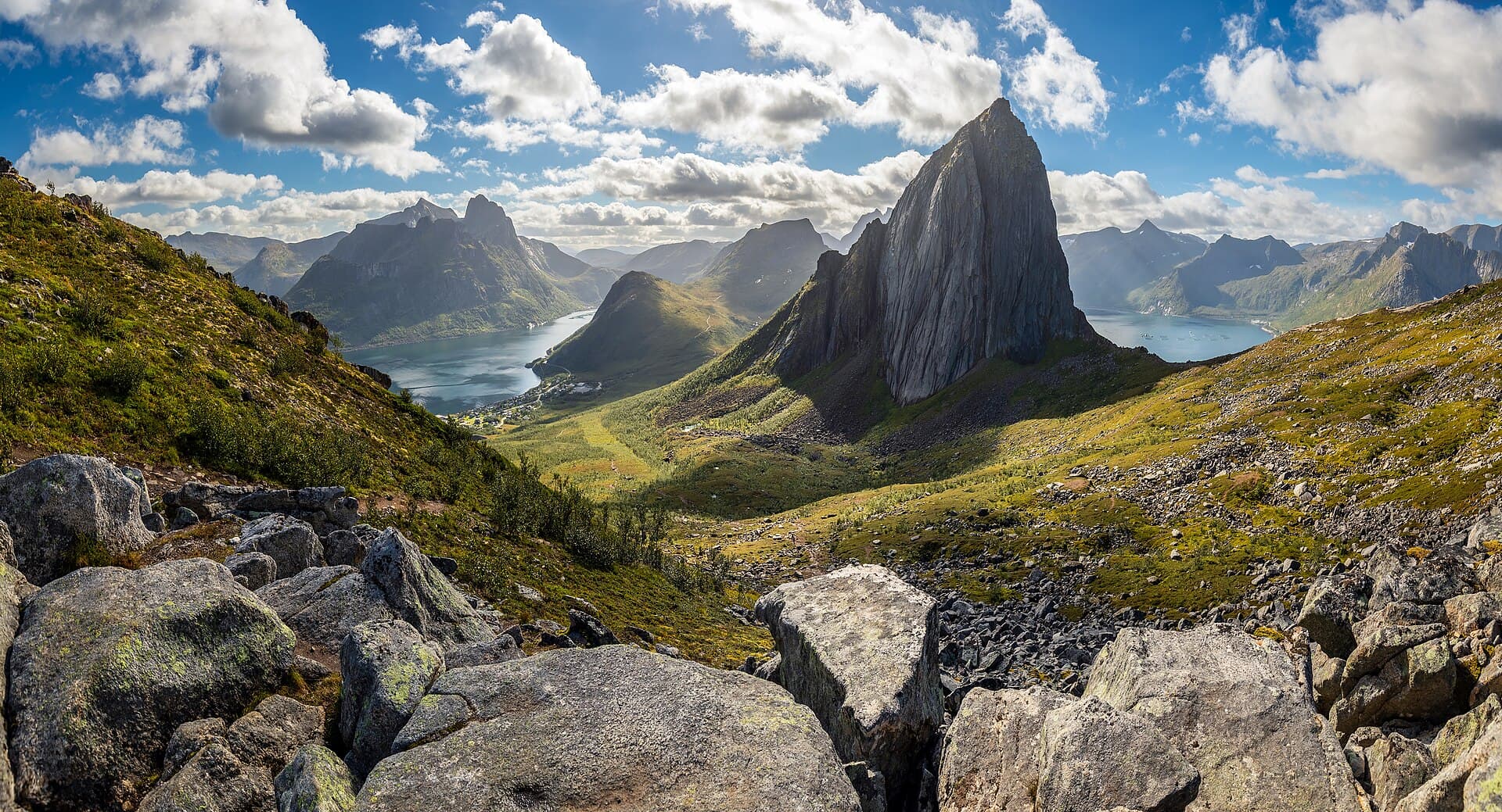
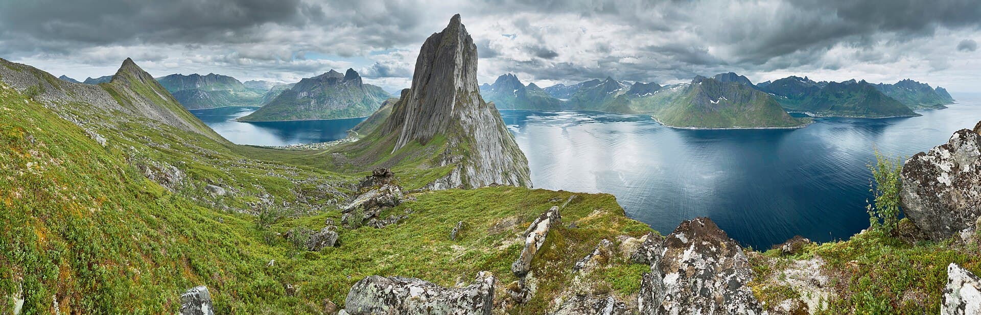
Hesten is the route most visitors mean when they picture Segla rising like a sail above the fjord. The upper ridge is still steep and edged by serious drops. It is a mountain hike, not an easy walk to a camera position.
Choose Segla when
Segla climbs the icon itself. The finish is steeper, looser and more exposed than Hesten, with rockfall potential from people above. Start, parking and current trail notices must be checked separately for the exact route.
The six mountain days
These are the main mountain hikes in the guide. Every time is an estimate without long stops, and every summit is optional when wind, visibility or footing deteriorates.
01
~4.5 km loop · ~3 hr · ~489 m · demanding
Choose Hesten when the view of Segla is the goal. The route rises from the Seglavegen side of Fjordgård through wet ground, rock and steeper upper terrain; the combined UT.no loop also visits Stavelitippen. The ridge has serious drops, so keep well back from edges and turn around when cloud, wind, snow or slippery rock removes your margin.
Check the current route (opens in a new tab)02
~4.6 km return · ~3 hr 30 min · ~588 m · demanding
Segla is the climb to the landmark itself, not the route for the familiar profile photograph. From the school side of Fjordgård, the final ridge becomes steep, loose and exposed. Rockfall from hikers above is a real concern. Choose it only with stable weather, sure footing and comfort in steep terrain; otherwise stop at the lower viewpoint or choose Hesten on another day.
Check the current route (opens in a new tab)03
~8.1 km return · ~4 hr · ~645 m · moderate
Husfjellet is the most approachable of the larger mountain days in this guide, with a clear trail from marked parking at Skaland and a steady climb through Sommardalen. It still covers real distance, wet ground and an exposed final viewpoint. It suits walkers who want a wide Bergsfjorden panorama without Segla’s steep finish, but not anyone unprepared for a four-hour mountain outing.
Check the current route (opens in a new tab)04
~5.9 km return · ~5 hr · ~609 m · demanding
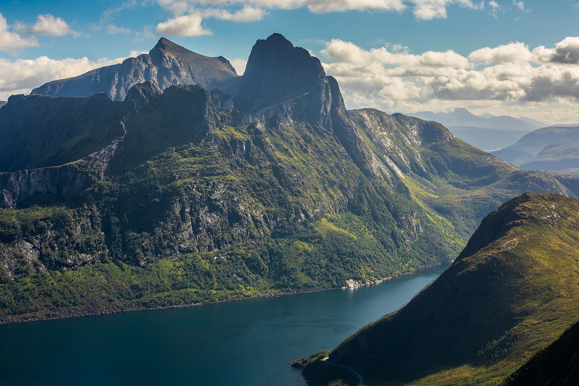
Barden gives you space, a high plateau and views across Mefjorden and Ørnfjorden. This comparison uses the Fjordgård route; the Mefjordeidet alternative has different distance and ascent figures. Expect boggy ground followed by a steeper upper section. It is often quieter than Hesten, but that does not make it easier or less weather-sensitive.
Check the current route (opens in a new tab)05
roughly 8–10 km · 5–7 hr · 820 m+ · demanding
This is a substantial two-summit day rather than a quick extension. Route totals vary with the start and whether you climb one or both peaks; published descriptions place the start around Mefjordeidet or road 862. Expect sustained ascent, rocky ground and exposed summit edges. Carry a proper route map and choose one peak when time, weather or energy is already narrowing the day.
Check the current route (opens in a new tab)06
~4 km return · ~3 hr · ~430 m · demanding
Sukkertoppen is short on the map but steep in practice. Routes begin near Hamn or Nikkelverket and meet before the final climb, where a chain assists on the steepest section. The reward is an open view over Bergsfjorden and Bergsøyene. Avoid the upper section in strong wind, poor visibility or when wet rock makes the descent uncertain.
Check the current route (opens in a new tab)Lower ground, larger margins
Easier is relative. Wet bog, coastal wind, cold rain and slippery rock can make a short route demanding, even when the map looks gentle and the elevation number is small.
About 4–4.5 km · 2–4 hr · family-friendly to moderate
A gentler introduction to Senja through old pine forest, water and a partly accessible gravel trail. The longer Simlestien loop adds wetter, less even ground. Check current national-park notices, including seasonal nature protections, before setting out.
Check the current route (opens in a new tab)About 8 km one way · allow 3–4 hr · easy to moderate
Visit Senja currently describes Dronningruta from Hofsøy to Ryvoll via Stongodden as roughly 8 km one way. It follows low coastal terrain, beaches and rock slabs, with a wetter inland return option. Arrange the return before starting and do not confuse it with similarly named hikes elsewhere in Norway.
Check the current route (opens in a new tab)About 3.6 km return · 1 hr · 165 m · moderate
This short South Senja walk starts around Lanesåsen, about two kilometres south of Stonglandseidet. The trail is relatively gentle and quickly opens views towards the islands, but wet ground and wind still matter. UT.no and Visit Senja publish slightly different distance conventions, so check the route you intend to follow.
Check the current route (opens in a new tab)About 1 hr · easy · 71 m ascent on the direct route
Knuten is the compact viewpoint option: a marked climb from the old football ground with a wide look over Mefjordvær and the sea. It can be linked with the wider village trail network. Even here, exposed coastal wind and slick ground can turn an easy classification into an uncomfortable outing.
Check the current route (opens in a new tab)Orientation
The map shows the whole island rather than zooming into one summit. Markers are hiking areas and approximate starts, not navigation tracks; use the linked route description and an offline topographic map on the trail.
Start area: Fjordgård / Seglavegen
Demanding
Start area: Fjordgård school area
Demanding
Start area: Skaland
Moderate
Start area: Fjordgård; alternatives exist
Demanding
Start area: Mefjordeidet / road 862 area
Demanding
Start area: Hamn / Nikkelverket
Demanding
Start area: Tranøybotn entrance
Family-friendly to moderate
Start area: Hofsøy or Ryvoll
Easy to moderate
Start area: Lanesåsen, south of Stonglandseidet
Moderate
Start area: Mefjordvær football ground
Easy
Place and peak positions were checked against OpenStreetMap data; the Grytetippen/Keipen start area was cross-checked against the current route description. Map tiles and place data © OpenStreetMap contributors.
Conditions before ambition
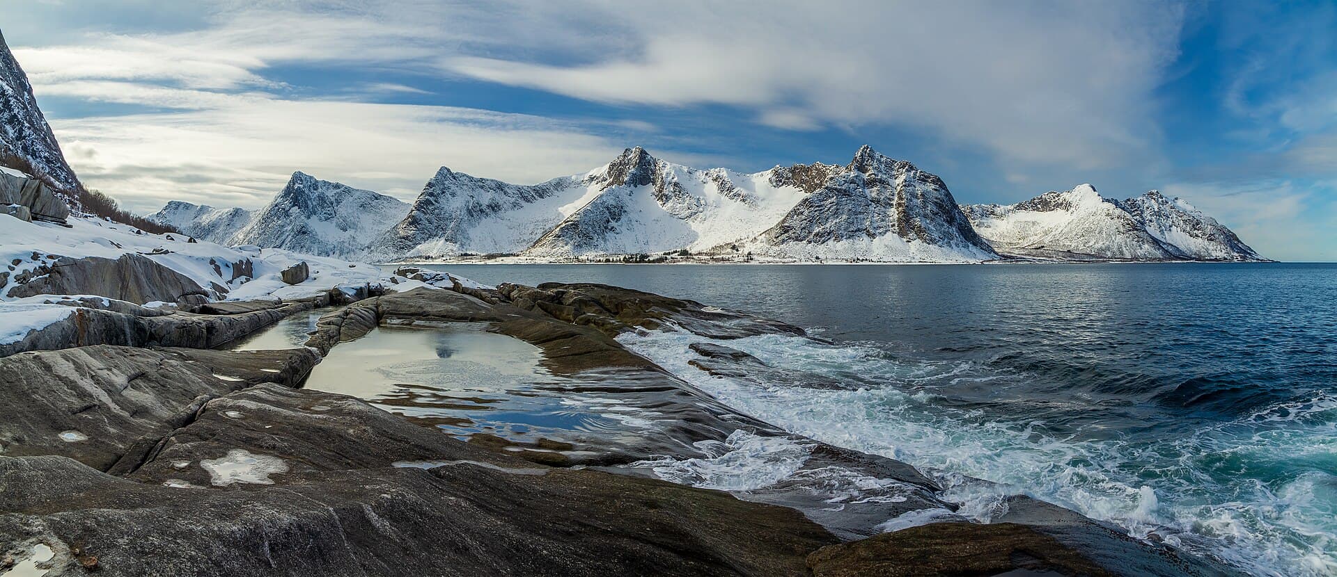
A dry road and a bright shoreline do not confirm a snow-free summit. High routes often settle into summer around mid-June, but every year differs, and early autumn snow can close the practical window again.
For higher routes, roughly mid-June through September is the usual starting point, not a guarantee. August and September can be beautiful, with faster changes in daylight, temperature and storms.
Summits can be colder and far windier than the trailhead. Expect wet bog on several routes, loose sand and gravel on Segla, and unprotected drops. Reassess at each terrain change.
Carry mountain footwear, a windproof layer, rainwear, extra warmth, food, water, offline navigation, a charged phone and first aid. Pack for a delay, not only the moving time.
Ankle injuries and rapid cooling are realistic risks. Turn around before footing or visibility fails. Winter hiking and avalanche terrain need separate training, forecasts and equipment and are not covered here.
Shared trailheads
Fjordgård and several other trailheads serve small communities. A full parking area is a reason to change the plan, not to create a new parking space.
Use public or signed spaces in Fjordgård and at other trailheads. Never block a private driveway, tunnel approach, passing place or emergency access.
Charges, overflow areas and local arrangements can change. Read signs on arrival. Popular starts can fill in high season, and availability is never guaranteed.
Follow the established trail, especially through wet ground and fragile vegetation. Shortcuts widen erosion and move pressure into the surrounding landscape.
Carry all waste out, keep noise low and give residents, livestock and wildlife room. Leave No Trace applies at the car park as much as on the summit.
Senja municipality's current trail plan lists Segla parking for Hesten and Segla, and parking south of Ørnfjordtunnelen for Grytetippen and Keipen. On-site signs and current local notices take precedence over this summary.
Questions before the trail
01
Hesten is the best-known choice for the classic view towards Segla. Husfjellet is a strong alternative for a broader coastal panorama and a friendlier trail, while the best choice on any day still depends on weather, ground conditions and experience.
02
Choose Hesten to see and photograph Segla. Choose Segla to climb the mountain itself. Segla has a steeper, looser and more exposed finish, and neither route should be treated as a simple photo walk.
03
Some are. Knuten, sections of the Ånderdalen trail, Dronningruta and Leirpollfjellet are the most approachable options here. Short distance does not remove wind, wet ground, cold or exposure, so beginners should still make a conservative plan.
04
The usual high-mountain hiking window is from roughly mid-June into September, but snow and trail conditions vary each year. August and September can be excellent, yet daylight, temperature and weather margins become smaller.
05
It is possible to reach some Senja communities by bus, but services and useful same-day connections are limited. Check Entur and the current local timetable before travel, and do not assume a bus will align with a mountain day or late return.
06
Use the marked public parking areas in Fjordgård and follow the signs for the route you intend to walk. Parking arrangements, summer overflow areas and charges can change, so confirm the signs on arrival and never use private driveways.
07
Breitinden is not a standard tourist hike. Current routes can be steep, exposed and very demanding, so visitors without suitable mountain experience should use a certified local guide and obtain current local advice.
08
For mountain routes, carry supportive hiking footwear, waterproof and windproof layers, extra warmth, food, water, offline navigation, a charged phone and first-aid supplies. Winter and avalanche terrain require different skills and equipment and are outside this summer guide.
Sources
Route facts were checked on 31 July 2026. Open the individual route link for the most relevant description, then confirm weather, hazards, parking signs and local notices immediately before the hike.
Image provenance
Photograph by Simo Räsänen (Wikimedia Commons), licensed under CC BY-SA 4.0 (opens in a new tab).
Resized local derivative; responsive cover crop in the hero.
View the original file on Wikimedia Commons (opens in a new tab)Photograph by Simo Räsänen (Wikimedia Commons), licensed under CC BY-SA 4.0 (opens in a new tab).
Resized local derivative; displayed at its full panoramic ratio.
View the original file on Wikimedia Commons (opens in a new tab)Photograph by Simo Räsänen (Wikimedia Commons), licensed under CC BY-SA 4.0 (opens in a new tab).
Resized local derivative; mild responsive cover crop.
View the original file on Wikimedia Commons (opens in a new tab)Photograph by Simo Räsänen (Wikimedia Commons), licensed under CC BY-SA 4.0 (opens in a new tab).
Resized local derivative; displayed at its full wide ratio.
View the original file on Wikimedia Commons (opens in a new tab)Independent planning guidance. Current official information always overrides this page.
Continue to the complete Senja travel guideGet occasional field notes, practical travel updates and new routes from across Norway.
Loading the email form…
No spam. Unsubscribe anytime. Read our Privacy Policy.